

Registration & profile management
GPS boundary mapping & geolocation
Visual monitoring & crop intelligence
Transparent grower–miller engagement
A digital foundation for a more transparent, efficient and data-driven sugar industry.
SugarVISTA helps register growers, map farms with GPS coordinates and farm polygons, visualise farms on satellite imagery, and support structured contracting between growers and millers. It is designed to strengthen traceability, planning, service delivery and decision-making across the sugar sector.



From grower registration to mapped farms and contract visibility, SugarVISTA supports an end-to-end digital workflow for the sugar value chain.

Field officers capture grower identity, contact information, location details and supporting records digitally.

Farm boundaries are captured using GPS points and polygons to create a precise digital representation of each field.

Mapped farms can be viewed spatially and overlaid with satellite imagery for better planning and oversight.

Grower–miller relationships and related records can be managed more transparently within one structured system.
A practical toolkit for registration, mapping, visualisation and field-level decision support.
Maintain complete grower records linked to specific farms and locations.
Capture and manage field boundaries for spatial planning and traceability.
View farms in a broader geographic context to support monitoring and analysis.
Enable clearer linkage between growers, farms and contracting arrangements.
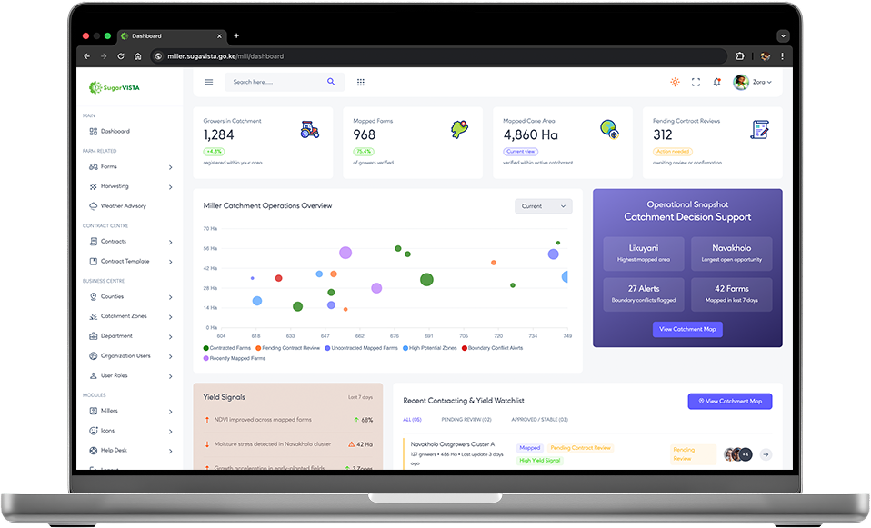
SugarVISTA is designed to improve visibility, accountability and planning across the sugar industry by connecting people, farms and location-based data in one ecosystem.
Strengthens visibility of farms, improves record accuracy, and supports fairer participation in formal industry systems.
Provides better geographic visibility of supply areas, clearer grower–farm linkage, and improved contracting support.
Creates a stronger evidence base for planning, oversight, traceability and future precision agriculture initiatives.
SugarVISTA is a smart digital platform supporting grower registration, farm mapping, satellite visualisation and transparent contracting in the sugar industry.
© SugarVISTA. All rights reserved.